Research path

Geolocation & Mapping

A focused view of OSINT4ALL tool profiles mapped to this investigation path.

13 mapped profiles No pay-to-rank ordering Open full filters anytime

How to use this path

  • Start broad here, then narrow in the directory filters.
  • Open profiles for limits, pricing, and verification notes.
  • Use collections when you need a workflow stack, not one tool.

Tool profile

Global Forest Watch

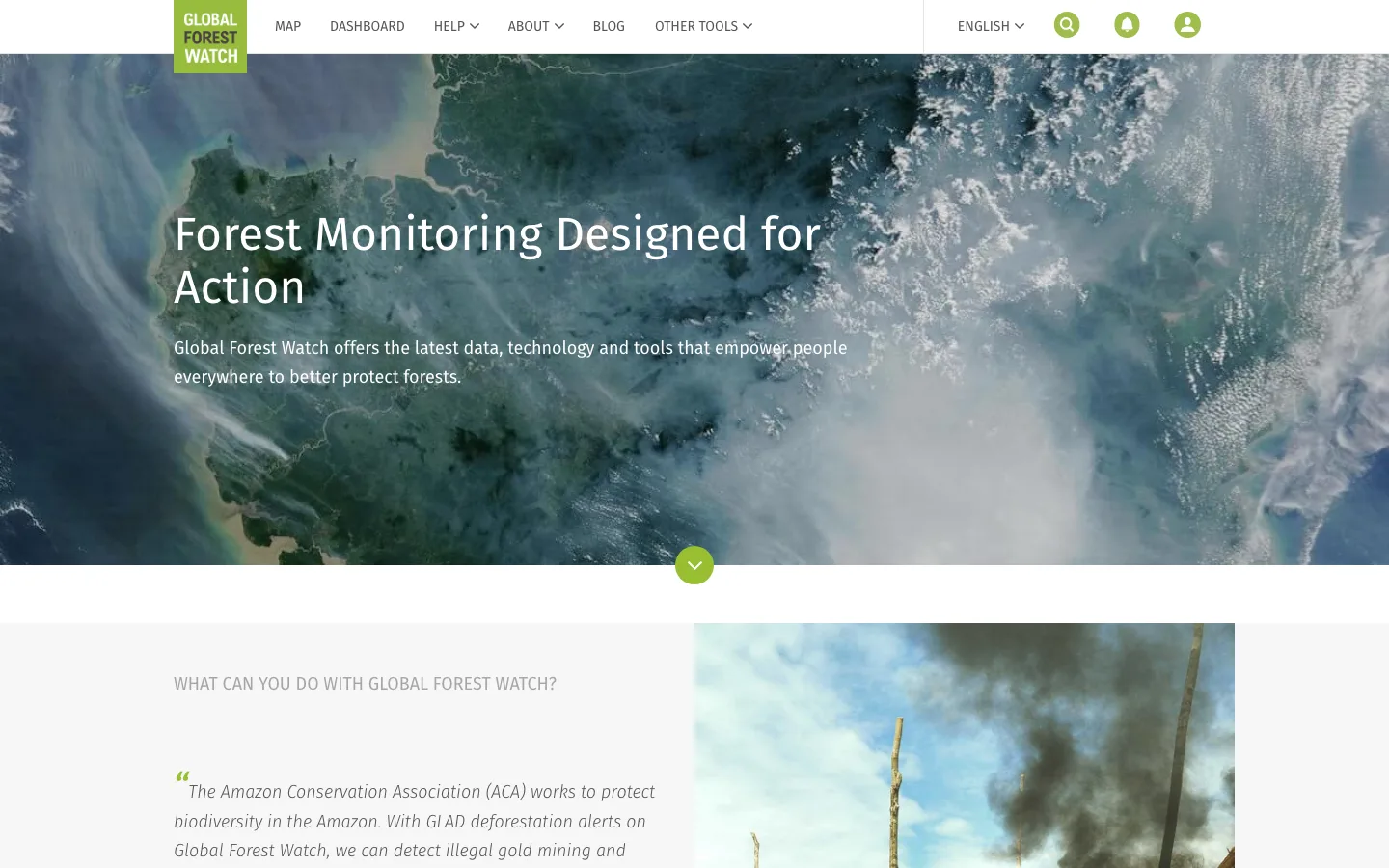
Forest monitoring, satellite alerts, and environmental geospatial data

WorkflowDiscovery, Verification AccessFree
Editorial
Open profile

Tool profile

OpenSky Network

Open ADS-B flight tracking and aviation data network

WorkflowDiscovery, Verification AccessFree
Editorial
Open profile

Tool profile

MapChecking

Crowd-size estimation from mapped areas

WorkflowReporting AccessFree
Editorial
Open profile

Tool profile

NASA Worldview

NASA satellite imagery browsing

WorkflowVerification AccessFree
Editorial
Open profile

Tool profile

Copernicus Browser

Copernicus satellite data browser

WorkflowVerification AccessFree
Editorial
Open profile

Tool profile

SunCalc

Sun and shadow checks for visual verification

WorkflowVerification AccessFree
Editorial
Open profile

Tool profile

OpenAerialMap

Open aerial imagery catalog for mapping workflows

WorkflowDiscovery AccessFree
Editorial
Open profile

Tool profile

Nominatim

OpenStreetMap geocoding and search

WorkflowEnrichment AccessFree
Editorial
Open profile

Tool profile

GeoNames

Structured geographic names database and gazetteer

WorkflowEnrichment AccessFree
Editorial
Open profile

Tool profile

Mapillary

Street-level imagery platform for geolocation and scene context

WorkflowMapping, Verification AccessFree
Editorial
Open profile

Tool profile

Overpass Turbo

OpenStreetMap query interface for geospatial clues

WorkflowMapping AccessFree
Editorial
Open profile

Tool profile

Sentinel Hub EO Browser

Browser-based satellite imagery exploration

WorkflowVerification AccessFreemium
Editorial
Open profile

Tool profile

Google Earth

Terrain, imagery, and 3D context for geolocation

WorkflowMapping AccessFree
Editorial
Open profile